
| To find links for a specific country, click on its initial letter here: |
|
If you don't find the country name you're looking for here, try the Country cross-reference page.
| Country | Primary | Secondary | Tertiary | Stats  | Postcode | Maps | TZs |
|---|---|---|---|---|---|---|---|
| Afghanistan | province | district | Stats Stats Stats | Atlas CIA Clik HCR Map Map Mgl PDF PDF | +04:30 | ||
| Åland Islands | municipality | Stats Stats | Post Post | Map Map Map | +02:00 D | ||
| Albania | county | district | commune | Stats | CIA HCR Map Map Map Map Mgl PDF PDF | +01:00 D | |
| Algeria | province | municipality | Stats Stats Stats Stats | CIA Map Map Mgl Mgl PDF PDF | +01:00 | ||
| American Samoa | district | county | Stats | Post | Atlas PDF PDF | -11:00 | |
| Andorra | parish | Stats Stats Stats Stats Stats | Post | Map Map Map | +01:00 D | ||
| Angola | province | council | Stats | CIA HCR Map Mgl PDF PDF | +01:00 | ||
| Anguilla | district | Stats | Map Map PDF | -04:00 | |||
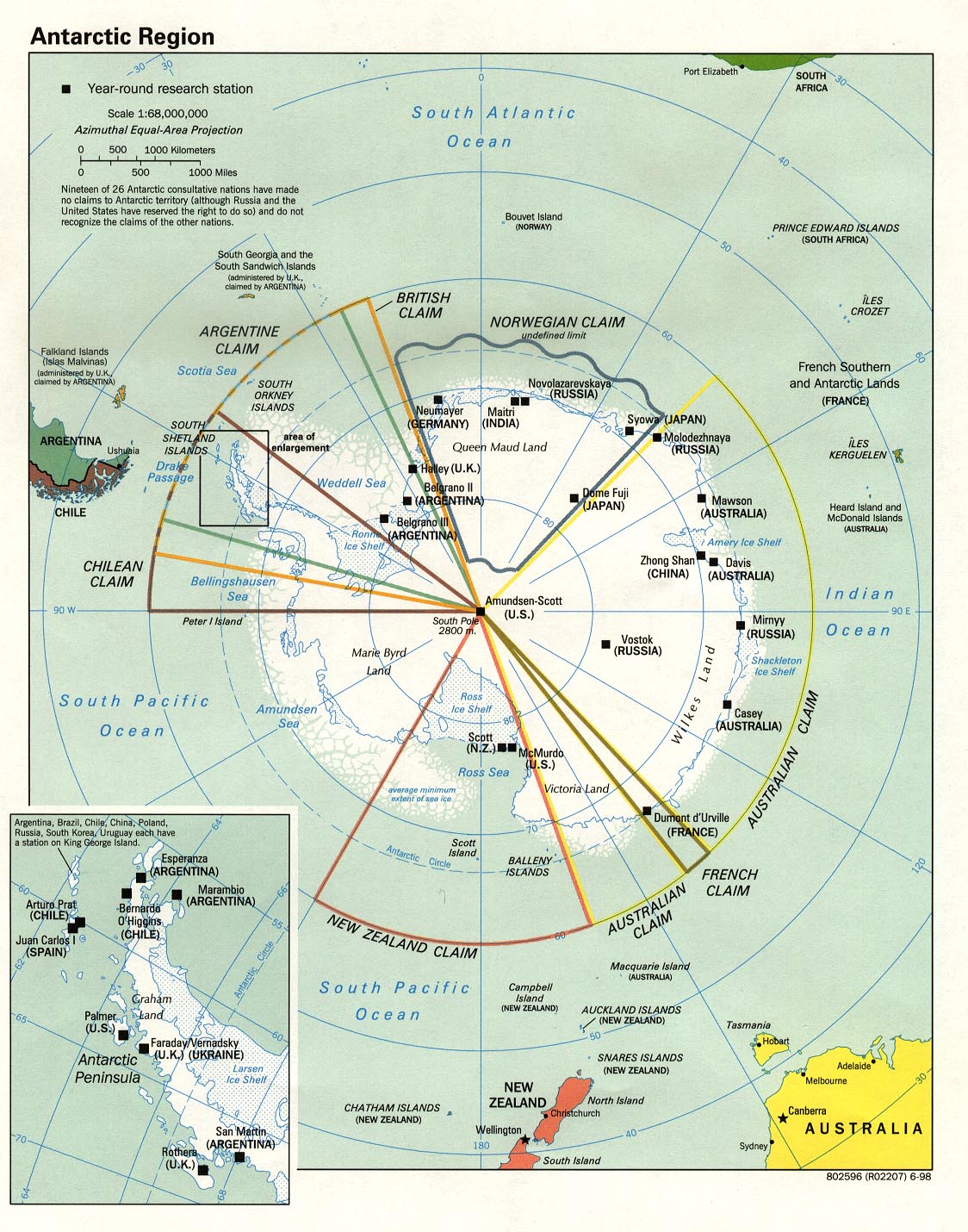
| Antarctica | claim | CIA | Zones D | ||||
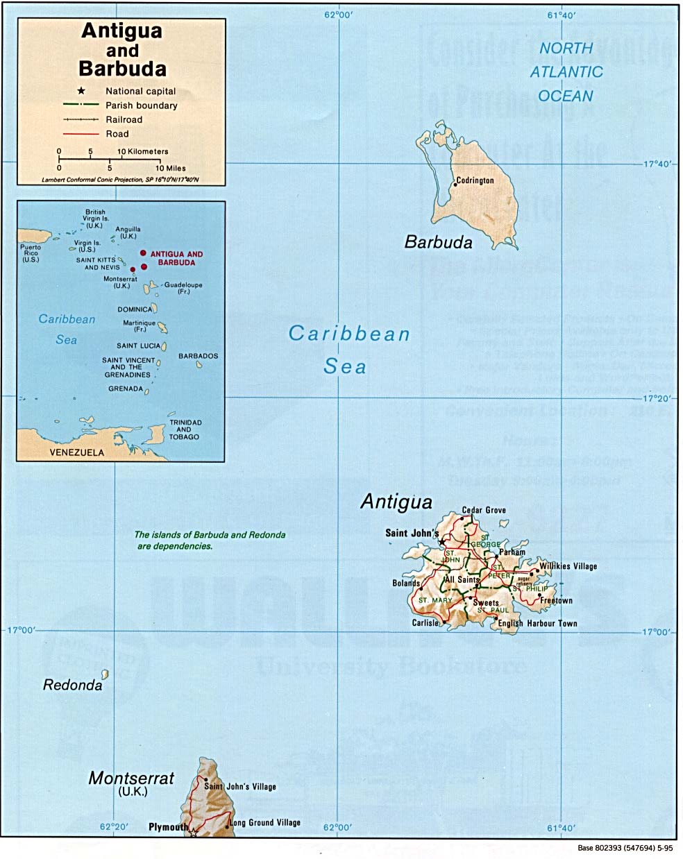
| Antigua and Barbuda | parish | Stats Stats | CIA Map Map Mgl | -04:00 | |||
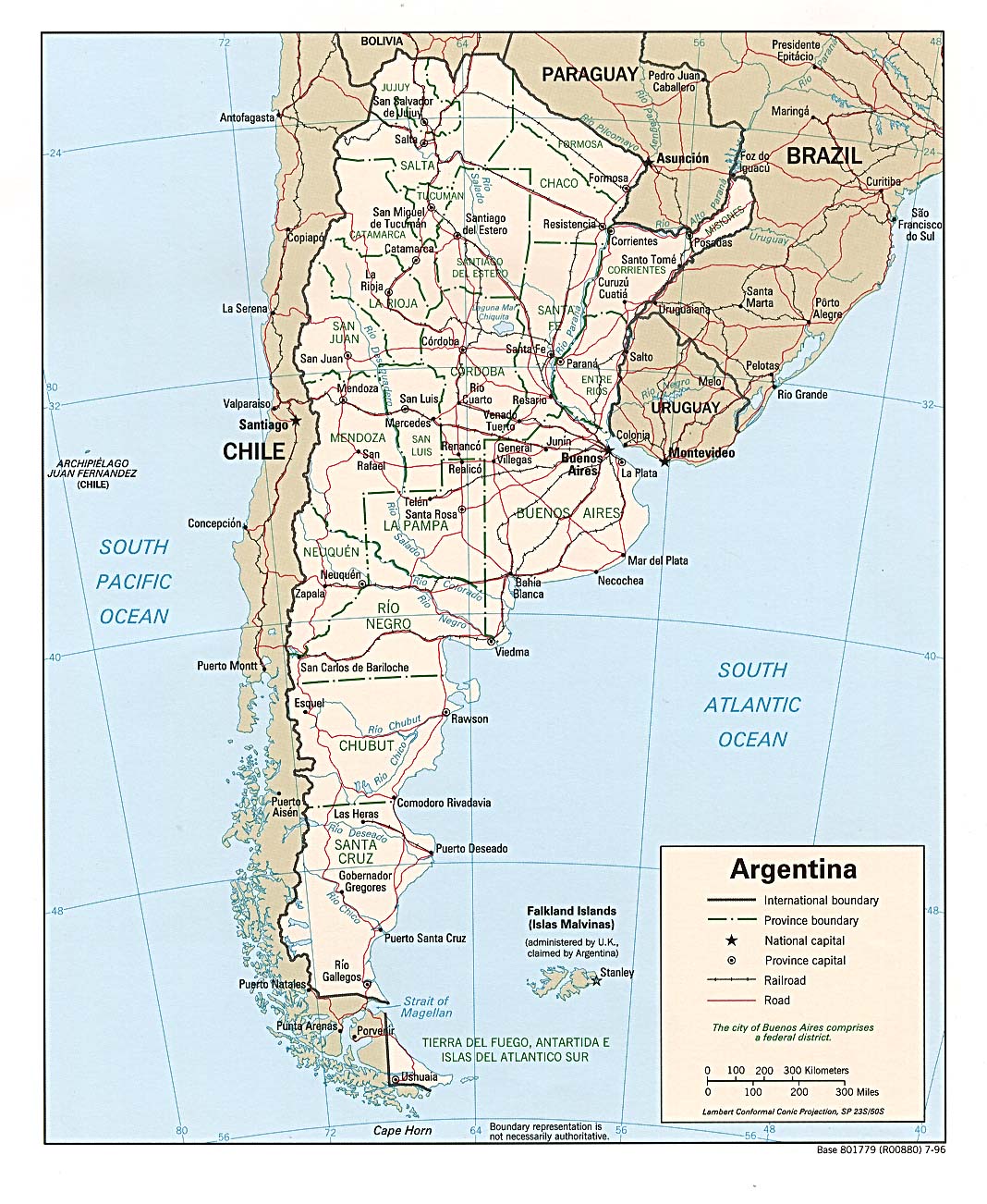
| Argentina | province | department | Stats Stats Stats | Post | CIA Mgl PDF | Zones | |
| Armenia | province | Stats Stats Stats | Clik Map | +04:00 | |||
| Aruba | none | Stats Stats Stats | Map | -04:00 | |||
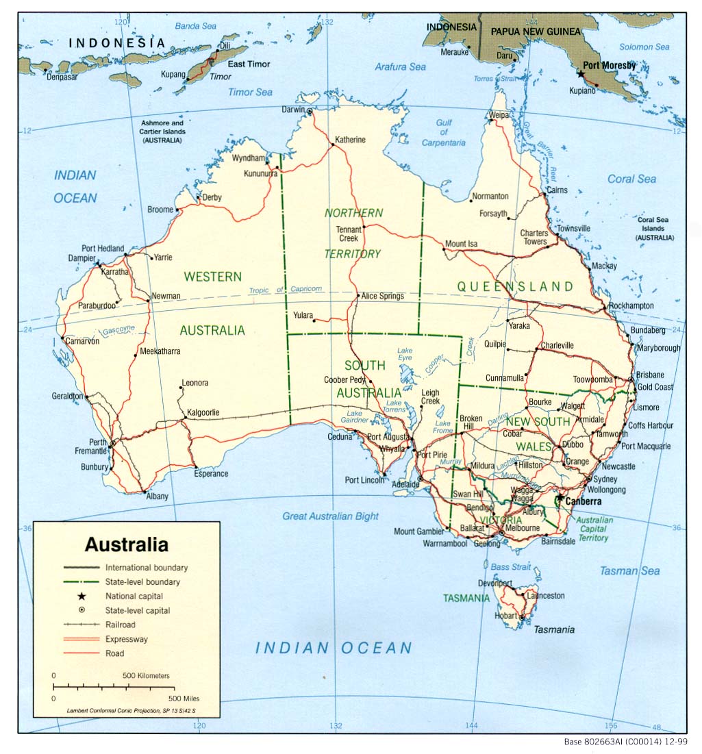
| Australia | state | shire | Stats Stats Qland | Post | CIA Map Mgl | Zones D | |
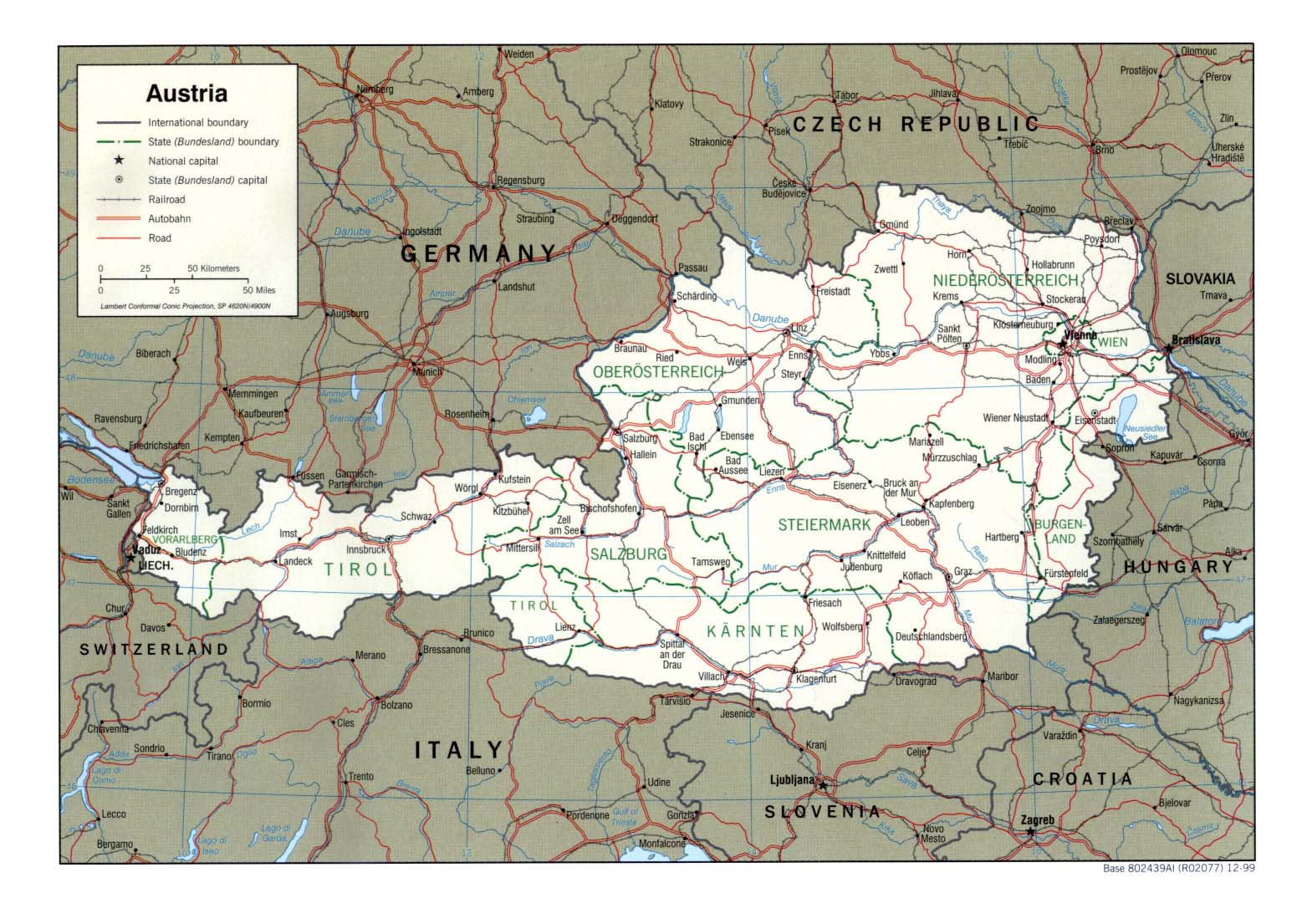
| Austria | state | district | Stats Stats Stats Stats | Post | CIA Map Mgl PDF | +01:00 D | |
| Azerbaijan | district | Stats Stats Stats Stats | Post Post | CIA Mgl PDF | +04:00 | ||
| |||||||
| To find links for another country, click on its initial letter here: |
|
| To find out which pages on this site have recently been updated, visit the newsletter page. |
The earth is the Lord's, and the fullness thereof; the world, and they that dwell therein. - Ps. xxiv:1.
| Back to main statoids page | Contact me |
| Copyright © 1999-2016 by Gwillim Law. | |