
| To find links for a specific country, click on its initial letter here: |
|
If you don't find the country name you're looking for here, try the Country cross-reference page.
| Country | Primary | Secondary | Stats  | Postcode | Maps | TZs |
|---|---|---|---|---|---|---|
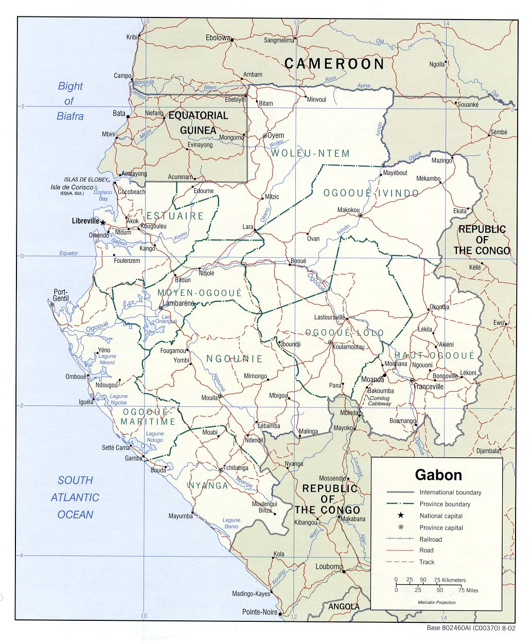
| Gabon | province | department | Stats | CIA Map Map Map Mgl PDF PDF | +01:00 | |
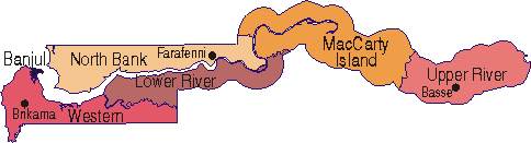
| Gambia | region | district | Stats Stats Stats | Atlas CIA Map Map Mgl Mgl PDF | 00:00 | |
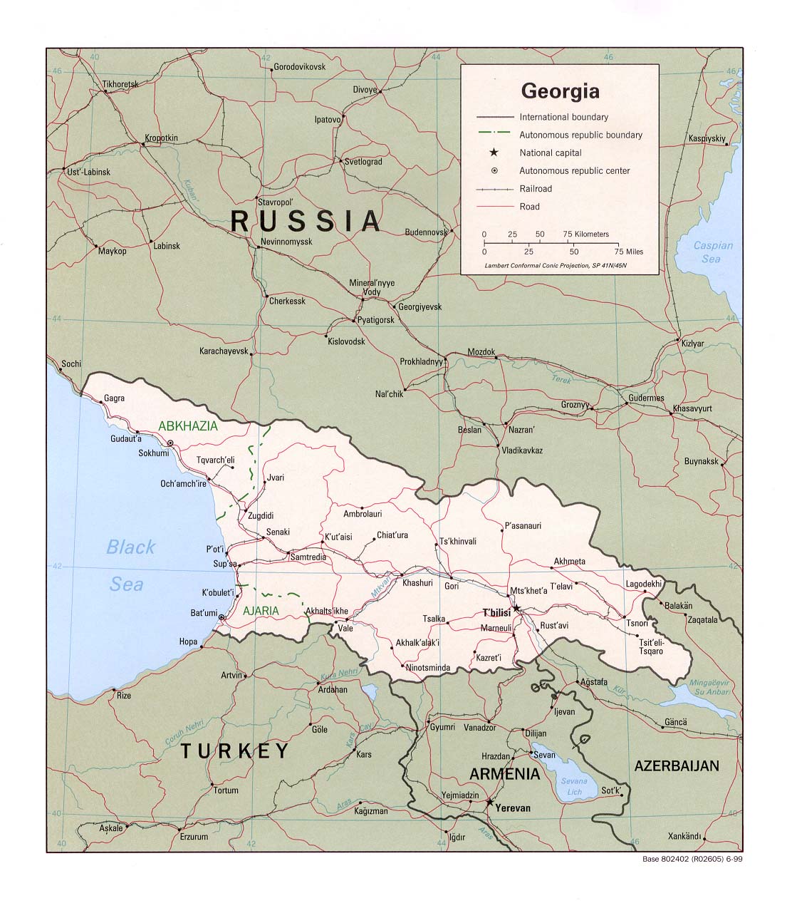
| Georgia | region | district | Stats Stats Stats | CIA Mgl PDF | +04:00 | |
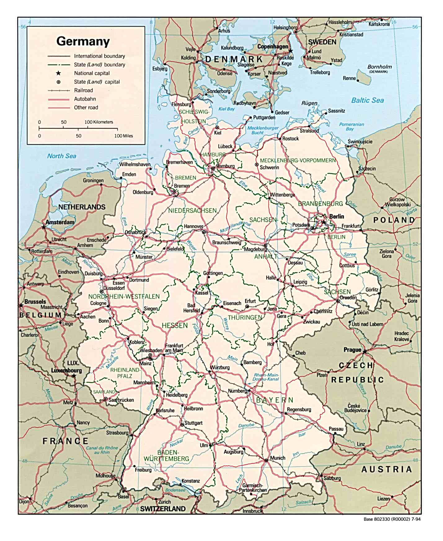
| Germany | state | district | Stats Stats Stats Stats | Post | CIA Map Mgl PDF | +01:00 D |
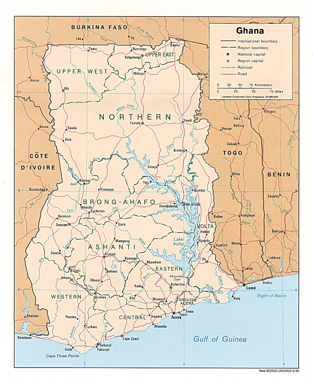
| Ghana | region | district | Stats | CIA Map Mgl PDF PDF | 00:00 | |
| Gibraltar | none | Stats Stats | +01:00 D | |||
| Greece | administration | municipality | Stats Stats Stats | CIA Mgl PDF | +02:00 D | |
| Greenland | commune | municipality | Stats | Custom | Zones D | |
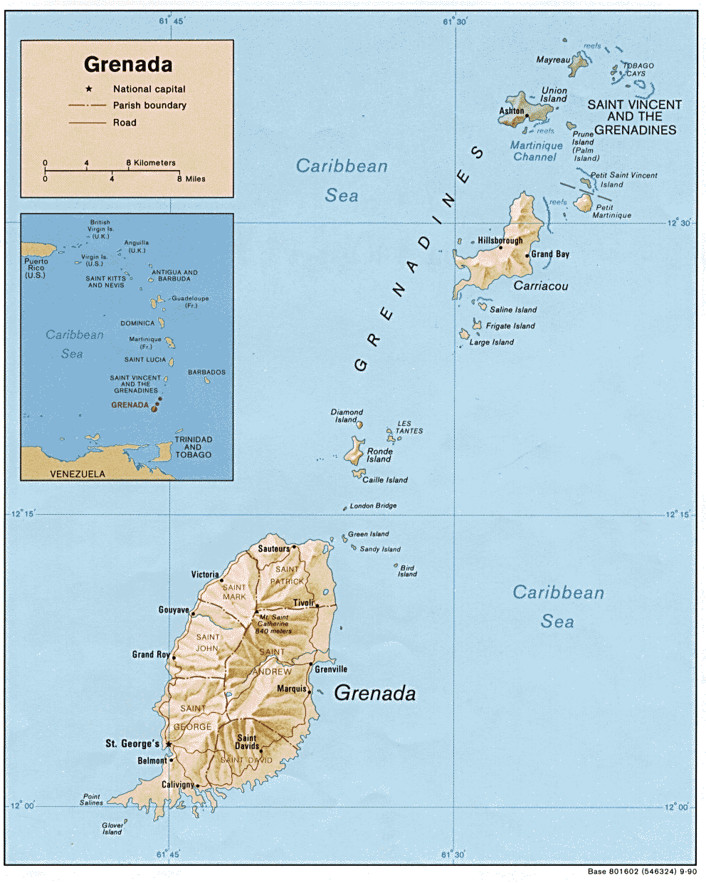
| Grenada | parish | CIA Mgl | -04:00 | |||
| Guadeloupe | arrondissement | commune | Stats | Map | -04:00 | |
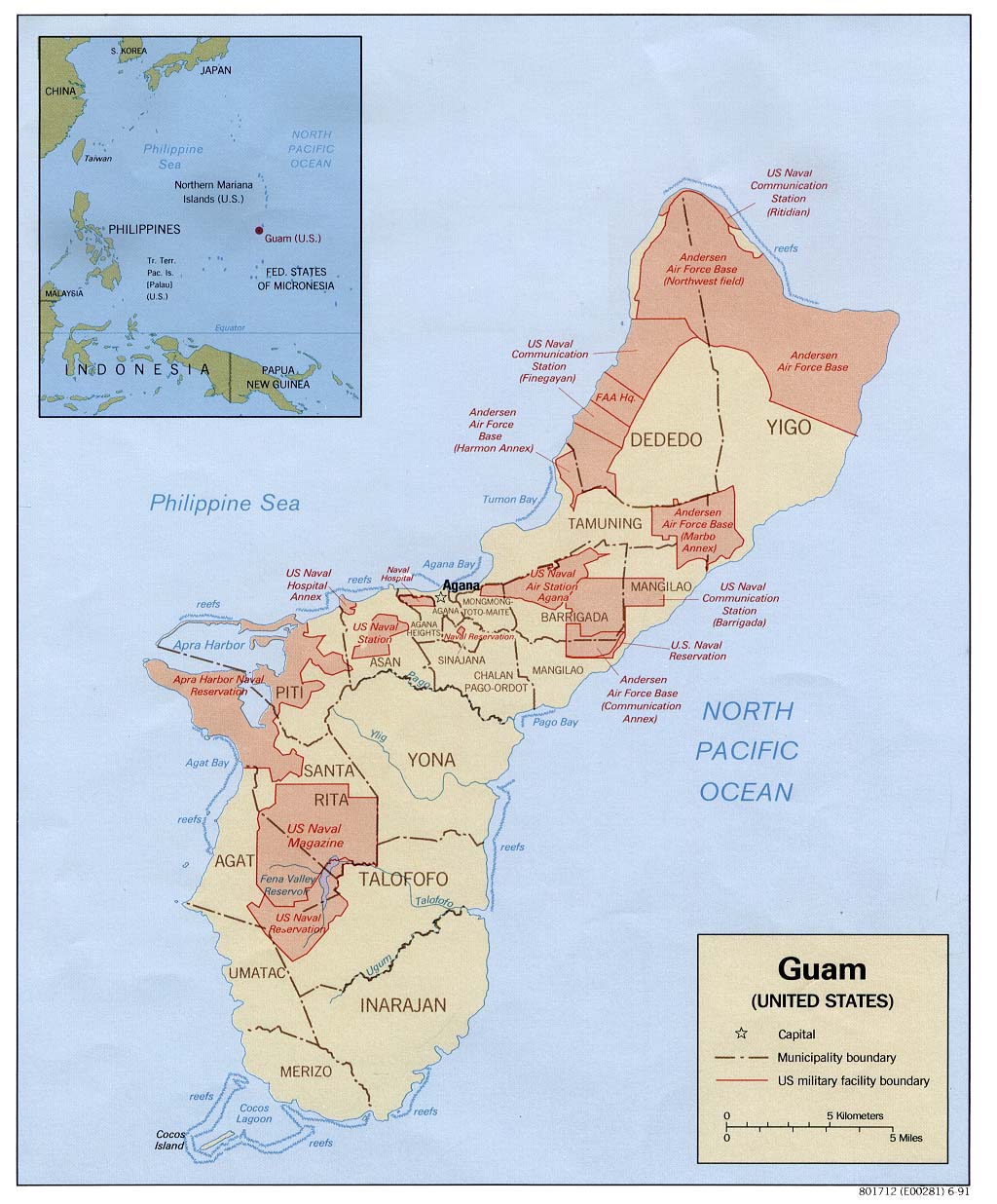
| Guam | municipality | Stats | CIA Mgl PDF PDF | +10:00 | ||
| Guatemala | department | municipality | Stats Stats | CIA Mgl PDF PDF | -06:00 | |
| Guernsey | parish | Stats | 00:00 D | |||
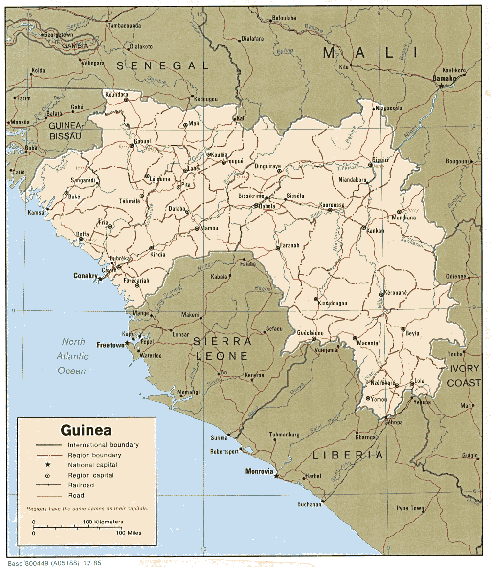
| Guinea | prefecture | subprefecture | Stats | CIA Map Map Mgl PDF PDF | 00:00 | |
| Guinea-Bissau | region | sector | Stats | CIA Map Map Mgl PDF PDF | 00:00 | |
| Guyana | region | council | Stats Stats | CIA Mgl PDF | -04:00 | |
| ||||||
| To find links for another country, click on its initial letter here: |
|
| To find out which pages on this site have recently been updated, visit the newsletter page. |
And before him shall be gathered all nations: and he shall separate them one from another, as a shepherd divideth his sheep from the goats. - Matt. xxv:32.
| Back to main statoids page | Contact me |
| Copyright © 1999-2015 by Gwillim Law. | |