Districts of Saint Lucia
Buy data Donate
Updates: 
"Geopolitical Entities, Names, and Codes, Edition 2" (GENC), a U.S. standard that's supposed to correspond to ISO 3166-2, was issued on
2014-03-31. It gives Canaries the code LC-12. Subsequently, on 2014-11-03, ISO officially issued a code for Canaries. It also
reclassified the divisions from quarters to districts. Now there is a perfect match between the two standards.
Update 15 to the GEC, the successor to the FIPS standard, is dated 2014-03-31. It changes the status of the divisions from quarters to districts, deletes Dauphin and Praslin, and inserts Canaries.
Justin Meyers forwarded me a pdf copy of the 2010 census report. I have used it to present better population data here. Using the contents of the pdf as a guide to search, I was able to locate it online (source [1]).
Country overview:
| Short name | SAINT LUCIA |
| ISO code | LC |
| GEC code | ST |
| Language | English (en) |
| Time zone | -4 |
| Capital | Castries |
Saint Lucia was a British possession until granted independence on 1979-02-22.
Other names of country:
- Danish: Saint Lucia
- Dutch: Sint Lucia, Saint Lucia
- Finnish: Saint Lucia
- French: Sainte-Lucie
- German: Sankt Lucia n
- Icelandic: Sankti Lúsía
- Italian: Santa Lucia, Saint Lucia
- Norwegian: Saint Lucia
- Portuguese: Santa Lúcia, Santa Luzia
- Russian: Сент-Люсия
- Spanish: Santa Lucía
- Swedish: Saint Lucia
- Turkish: Saint Lucia (formal)
Origin of name:
after Saint Lucy (3rd cent.)
Primary subdivisions:
Saint Lucia is divided into ten districts.
| District | HASC | ISO | GEC | Population | Area(km.²) | Area(mi.²) |
|---|---|---|---|---|---|---|
| Anse-la-Raye | LC.AR | 01 | ST01 | 6,247 | 47 | 18 |
| Canaries | LC.CN | 12 | ST12 | 2,044 | 78 | 30 |
| Castries | LC.CS | 02 | ST03 | 65,656 | 79 | 31 |
| Choiseul | LC.CH | 03 | ST04 | 6,098 | 31 | 12 |
| Dennery | LC.DE | 05 | ST05 | 12,599 | 70 | 27 |
| Gros Islet | LC.GI | 06 | ST06 | 25,210 | 101 | 39 |
| Laborie | LC.LB | 07 | ST07 | 6,701 | 38 | 15 |
| Micoud | LC.MI | 08 | ST08 | 16,284 | 78 | 30 |
| Soufrière | LC.CO | 10 | ST09 | 8,472 | 51 | 20 |
| Vieux Fort | LC.VF | 11 | ST10 | 16,284 | 44 | 17 |
| 10 districts | 165,595 | 617 | 239 | |||
| ||||||
Discussion:
I have ample evidence that the divisions above are correct, and have been for at least several decades. However, some usually reliable sources disagree. Here are the details.
First, there is some disagreement over the correct generic term for the divisions. The most recent official document (source [1]) consistently calls them "districts". Some older census reports call them "districts/parishes". The FIPS and ISO standards regularly call them "quarters", or "quartiers" in French; but in 2014, GEC went back to "districts".
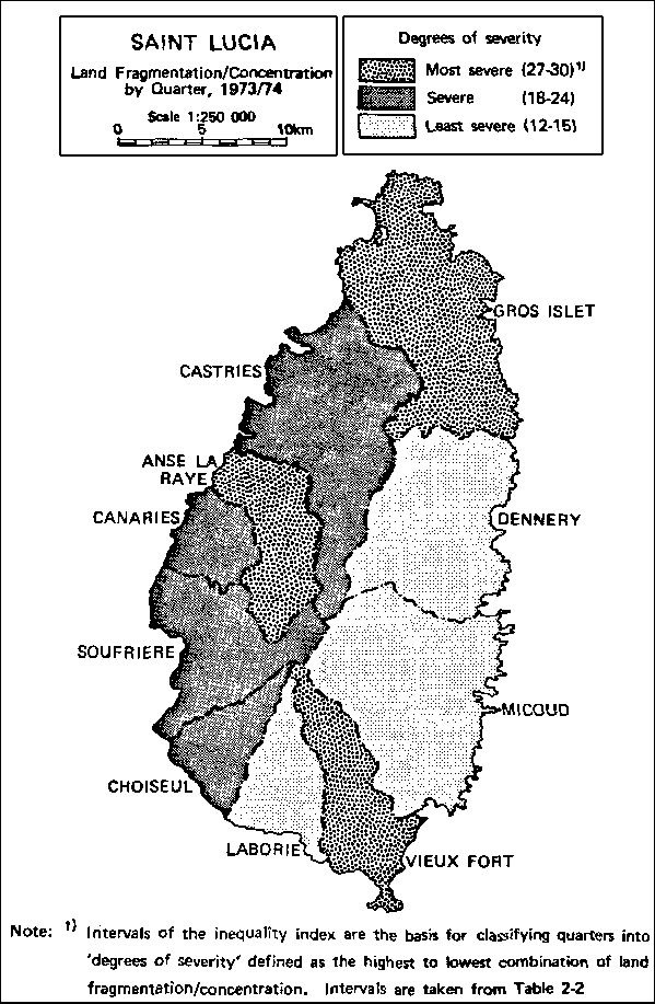
The U.S. government got it right in 1972 (source [7]). Something went wrong between that document and its successors: FIPS standard 10, and the more recent "Geopolitical Entities and Codes". Since 1984 or earlier, these standards have shown a slightly different subdivision of St. Lucia. They have been listing the districts as Anse-la-Raye, Castries, Choiseul, Dauphin, Dennery, Gros Islet, Laborie, Micoud, Praslin, Soufrière, and Vieux Fort (eleven divisions instead of ten). The same list has appeared in the CIA World Factbook, and matches the divisions shown on the CIA map of Saint Lucia (source [4]). Comparing the CIA map to the OAS map (source [3]), the following areas match up approximately: Gros Islet in the OAS version is Gros Islet and Dauphin in the CIA version; Anse-la-Raye and Canaries correspond to Anse-la-Raye; and Micoud corresponds to Micoud and Praslin. Finally, in 2014, the latest GEC update has got it right once again, deleting Dauphin and Praslin and restoring Canaries.
ISO/DIS 3166-2 (draft international standard), dated 1996, showed Saint Lucia divided into eight "administrative regions". ISO 3166-2:1998 was published on 1998-12-15. It said only that there were eleven quarters, without mentioning their names; these divisions were "not relevant". ISO 3166-2:2007 was published on 2007-12-15. It lists eleven quarters, giving the same names as the U.S. government version (with the minor variation that Anse la Raye has spaces rather than hyphens).
Some of the sources that support my conclusion of ten districts include [1], [2], [3], [7], and [8]. Source [5] (1997-1998 edition) says "there are 10 administrative districts", and more recently, the 2006 and 2008 editions actually have the same list that I do. Source [6] says Saint Lucia is "divided into 9 quarters and the town of Castries".
To be precise, the map on the first page of source [1] shows one additional division labeled "Forest Land". Compared to the OAS map, it should be an inland part of Castries. In the census tables, though, "Forest Land" is not listed as one of the divisions.
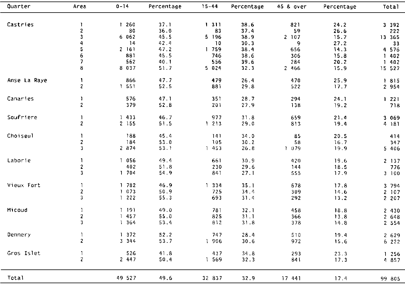
Sources [8] and [9] both give 1970 census data, but differ in the details. As you will see, source [9] is more consistent, and I have used it for the figures in the Population history. Source [8] calls the divisions quarters; source [9], districts. One figure in source [8] is clearly wrong (row 6, column 9, the total population of Castries area 6 should be 1,993, to be consistent with all the other figures in that row; apparently the figure 1,402 was accidentally copied from the row below it). Source [8] also seems to have misplaced 2,513 people somewhere, because the sum of the populations of individual census areas fall short of the reported total population by 2,513. Source [8] gives a country total population of 99,805, which is 1 less than the total from source [9]. The two sources are in perfect agreement about the identity and population of Anse-la-Raye, Canaries, Choiseul, Dennery, Gros Islet, Laborie, Soufrière, and Vieux Fort. They agree that there is another division called Micoud, but they give different populations for it. The population of Micoud according to source [9] is 2,513 greater than that in source [8], which would account for the missing persons in source [8]; possibly Micoud has a fourth area that was accidentally omitted from the body of the table. Castries in source [8] is replaced by three districts in source [9], which it calls "Sub of Castries," "Town of Castries," and "Marchand." The total population of those three is just 1 more than the population of Castries in source [8]. That accounts for the difference in total population between the two sources. Conclusion: in 1970, Castries was probably equivalent to what source [9] calls Town of Castries, Sub[urbs?] of Castries, and Marchand. I have no other evidence for the existence of Marchand.
Territorial extent:
Vieux Fort includes the small Maria Islands.
The UN LOCODE page  for Saint Lucia lists locations in the country, some of them with their latitudes and longitudes, some with their ISO 3166-2 codes for their subdivisions. This information can be put together to approximate the territorial extent of subdivisions.
Population history:
| District | 1970-04-07 | 1980-05-12 | 1991-05-12 | 2001-05-22 | 2010-05-10 |
|---|---|---|---|---|---|
| Anse-la-Raye | 4,769 | 4,362 | 5,035 | 6,060 | 6,247 |
| Canaries | 1,939 | 1,559 | 1,799 | 1,788 | 2,044 |
| Castries | 40,451 | 45,048 | 51,994 | 64,344 | 65,656 |
| Choiseul | 6,167 | 5,549 | 6,405 | 6,128 | 6,098 |
| Dennery | 8,851 | 9,676 | 11,168 | 12,767 | 12,599 |
| Gros Islet | 6,113 | 11,701 | 13,505 | 20,872 | 25,210 |
| Laborie | 6,013 | 6,490 | 7,491 | 7,363 | 6,701 |
| Micoud | 10,145 | 13,072 | 15,088 | 16,041 | 16,284 |
| Soufrière | 7,250 | 6,657 | 7,683 | 7,656 | 8,472 |
| Vieux Fort | 8,108 | 11,385 | 13,140 | 14,754 | 16,284 |
| Total | 99,806 | 115,499 | 133,308 | 157,775 | 165,595 |
Sources: 1970 - [9]; 1980 - [2]; 1991, 2001, 2010 - [1].
Sources:
- [1] 2010 Population
and Housing Census Preliminary Report (Updated April 2011). Central Statistics Office, Castries
(retrieved 2011-04-29). I used Table 1B, p. 9: Enumerated Household Population and Estimated Household Population by District, and Table
7, p. 16: Estimated Household Population for Census 1991, 2001 and 2010. For 2010, the estimated population is about 9% higher than the
enumerated population.
- [2] Estimated Mid-Year Population by District ,
Government Statistics Dept. (retrieved 2001-04-12, and again 2011-04-29).
- [3] OAS Map (retrieved about
2001-01-01). See source [8] for further bibliographic details.
- [4] CIA Map (retrieved about
2001-01-01).
- [5] The Statesman's Yearbook, 1997-1998 edition; 2006 edition.
- [6] The Encyclopædia Britannica World Atlas (1964 edition).
- [7] "Geopolitical Data Elements and Related Features", Defense Intelligence Agency Manual 65-18. Washington, 1972-09-29.
- [8] Saint Lucia Natural Resources and Agricultural Development
Project - Studies and Proposals for the Implementation of a Land Registration Programme . Table D-1:
Population Age Structure, by Quarter and Area, 1970. OAS, Washington, 1986 (retrieved 2011-04-29). Credits 1970 Population Census as its
data source.
- [9] 1979 Demographic
Yearbook , 31st Ed. Statistical Office, United Nations, New York, 1980 (retrieved 2011-12-28).
| Back to main statoids page | Last updated: 2015-06-30 |
| Copyright © 1999, 2001, 2003, 2005, 2007, 2008, 2011, 2014, 2015 by Gwillim Law. | |